


New Zealand Topo Maps
Opis aplikacije New Zealand Topo Maps
Апликација за навигацију на отвореном са најновијим топографским мапама Новог Зеланда, Острва Кука и Токелауа.
Ова апликација вам пружа сличне могућности мапирања као што бисте могли знати из Гармин или Магеллан ГПС преносника.
Главне карактеристике за спољну навигацију:
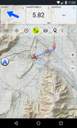
• Креирајте и уредите Ваипоинтс
• ГоТо-Ваипоинт-Навигатион
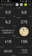
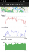
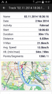
• Снимање записа (са профилом брзине, висине и тачности)
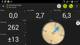
• Трипмастер са пољима за бројач километара, просечну брзину, лежај, надморску висину, итд.
• ГПКС-увоз / извоз, КМЛ-извоз
• Претрага (имена места, тачке интереса, улице)
• Прилагодљива поља података у приказу мапе и Трипмастеру (нпр. Брзина, удаљеност, компас, ...)
• Дељење путних тачака, стаза или рута (путем е-маила, Фацебоока, ..)
• Користите координате у УТМ, ВГС84 или МГРС
• и још много тога ...
Доступни основни слојеви мапе:
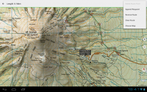
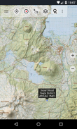
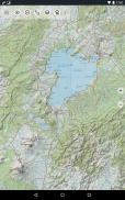
• Топомапс Нови Зеланд (бешавна покривеност у скали 1: 250.000 и 1: 50.000)
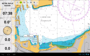
• НЗМаринер (РНЦ наутичке карте)
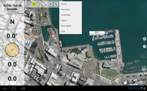
• ЛИНЗ ваздушне слике
• Гоогле мапе (сателитске снимке, мапе пута и терена)
• Отворите мапе улица
• Бинг Мапе
• ЕСРИ мапе
Прекривни слојеви:
• Јавна подручја заштите
• Отворена ловна подручја
• ДОЦ кампови
• Ограничења камповања слободе ДОЦ-а
• ДОЦ колибе
• ДОЦ ТРацкс
• Риболовни крај пастрмка Таупо
• Спрам
Користите ову навигацијску апликацију за активности на отвореном као што су планинарење, бициклизам, кампирање, пењање, јахање, скијање, кану или ванбродске 4ВД туре.
Учитајте БЕСПЛАТНЕ податке карата за подручја без сервиса ћелије. (Само за Про верзију)
ОГРАНИЧЕЊА БЕСПЛАТНЕ ВЕРЗИЈЕ:
• Огласи
• Макс. 3 путне тачке
• Макс. 3 нумере
• Нема рута
• Нема увоза путних тачака и стаза
• Нема преоптерећења
• Нема локалног ДБ-а (оффлине претрага)
Топографске мапе су креирале Ланд Информатион Нев Зеаланд (ЛИНЗ).
Топо50 је званична серија топографских карата које користе новозеландске службе за ванредне ситуације.
Како се користе топографске информације
Планирање одбране: Одбрамбене снаге Новог Зеланда користе топографске информације за планирање војних вежби и размену информација са међународним партнерима.
Локација и усмјеравање: Трагање и спашавање, одбрана, хитна помоћ, ватрогасна служба, полиција и службе цивилне заштите користе топографске информације у широком распону планирања и оперативних ситуација, од природних катастрофа до рада у заједници. Употреба може укључивати мобилне / теренске и контролне просторије и комбинацију топографских информација са другим подацима.
Управљање земљиштем: Топографске информације локална управа користи за регионално планирање и операције, као и компаније за напајање, гас и телекомуникације.
Поред тога, ЛИНЗ мапе се користе у разне сврхе од стране предузећа и владиних одељења, као што је Министарство за заштиту природе, и рекреативних корисника, као што су трампери и туристи.
Све топографске мапе имају додатне налепнице за бољу читљивост на већој скали зума. Мапе се приказују уз Атлогис® брвнаре ради побољшања топографије.
Покривеност Топо мапе:
Нови Зеланд и острва (Антиподес, Ауцкланд, Боунти, Цампбелл, Цхатхам, Кермадец, Раоул, Снарес и Стеварт) у размери 1: 50.000 и 1: 250.000
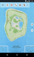
Острва Кука (Аитутаки, Атиу, Мангаиа, Манихики, Мауке, Митиаро, Палмерстон, Пенрхин, Пукапука, Ракаханга, Раротонга, Суварров, Такуте) у размери 1: 25.000
Острва Токелау (Атафу, Нукунону, Факаофо) у размери 1: 25.000
Молимо пошаљите коментаре и захтеве за функције на нзмапс@атлогис.цом
New Zealand Topo Maps - Verzija 7.5.0
(04-10-2024)New Zealand Topo Maps - Informacije o APK datoteci
Verzija APK datoteke: 7.5.0Paket: com.atlogis.nzmaps.freePoslednja verzija aplikacije New Zealand Topo Maps
Druge verzije


Aplikacije u istoj kategoriji

Možda će vam se takođe dopasti i...


